
The cultural landscape reflects the visible human imprint on the natural environment, revealing patterns of life, heritage, belief, adaptation, and history across space and time.
What Is a Cultural Landscape?
A cultural landscape is the result of interactions between human beings and the natural environment. It is the visible expression of human activity and cultural values on the Earth's surface. These landscapes are shaped by the cumulative actions of people over time and can include buildings, agricultural fields, roads, religious structures, and much more.
Examples of cultural landscapes include:
The French Quarter in New Orleans, showing French and Spanish colonial influence through architecture and street names.
Mosques and minarets in Istanbul, reflecting Islamic architectural traditions.
Rice terraces in Southeast Asia, illustrating agricultural adaptations to mountainous terrain.
Cultural landscapes reflect economic practices, religious beliefs, architectural preferences, and historical events that shape how people live and interact with the land.
Cultural Ecology and Human-Environment Interaction
Cultural ecology is the study of the relationship between people and their environment. It focuses on how cultural practices evolve in response to environmental constraints and opportunities.
In desert regions such as North Africa and the Middle East, traditional homes may be made from mud brick, with small windows to reduce heat gain.
In tropical climates, wide roofs and elevated foundations help buildings withstand heavy rainfall and flooding.
Societies living near rivers or lakes often develop fishing and irrigation systems, influencing diet, economy, and settlement layout.
Cultural ecology emphasizes that physical geography shapes cultural behavior, but humans also adapt and alter their environment to meet cultural and economic needs.
Sequent Occupancy
Sequent occupancy is the concept that different cultural groups leave lasting imprints on a place as they occupy it over time. These layers of cultural influence contribute to a multi-layered cultural landscape.
In Mexico City, remnants of the Aztec city of Tenochtitlan are buried beneath Spanish colonial architecture, which is now overlaid by modern buildings.
In Bolivia, cultural landscapes reflect influences from the Inca Empire, Spanish colonization, and modern Latin American culture.
Each successive culture adapts to the landscape in its own way, but traces of earlier inhabitants remain. These traces may include architectural ruins, place names, street layouts, religious institutions, and farming systems.
Adaptive Strategies
Adaptive strategies refer to the specific ways in which societies respond to their physical and cultural environments in order to survive and thrive. These strategies affect how societies organize agriculture, build homes, develop infrastructure, and manage resources.
Examples include:
Irrigation systems in arid regions like Egypt and the American Southwest.
Terraced farming in steep mountainous areas like the Philippines or Peru.
Stilt houses in flood-prone areas such as Bangladesh or the Amazon basin.
Adaptive strategies are often shaped by the availability of natural resources, climate, and cultural traditions passed down over generations. Over time, they contribute to the distinctive appearance and functionality of a cultural landscape.
Symbolic Landscapes
A symbolic landscape is one that holds meaning beyond its physical form. These landscapes embody cultural, religious, or political significance, often serving as powerful symbols of collective identity.
Examples of symbolic landscapes include:
The Temple Mount in Jerusalem, sacred to Jews, Muslims, and Christians, containing the Western Wall, Al-Aqsa Mosque, and Dome of the Rock.
The National Mall in Washington, D.C., which includes monuments that represent American ideals, historical events, and leaders.
Mount Rushmore, representing national pride and the American presidential legacy.
These landscapes become sites of memory, pilgrimage, or political symbolism, and are often the focus of contestation or preservation efforts.
Cultural Regions and Their Role in Shaping Landscapes
Cultural landscapes are often associated with specific types of regions that help geographers understand the spatial distribution of cultural traits.
Formal Regions
Formal cultural regions are areas in which people share one or more cultural traits, such as language, religion, or ethnicity. These regions have clearly defined boundaries and are often mapped and measured.
The French-speaking region of Canada, mainly Quebec, forms a formal cultural region.
Latin America is a formal region defined by the widespread use of Spanish and Portuguese, along with Catholicism.
Functional Regions
Functional regions are organized around a central node or focal point and defined by the flow of goods, services, or information.
The New York City metropolitan area is a functional region connected by transportation networks, media, and economic activity.
A radio broadcast area or a sports team fan base also represents a functional cultural region.
Functional regions are dynamic and often change over time based on economic, political, or technological developments.
Perceptual (Vernacular) Regions
Perceptual or vernacular regions are areas that exist in the minds of people and are defined by shared perceptions, images, and cultural identity.
The Bible Belt in the southern United States is associated with conservative Protestant values and church attendance.
Chinatowns in major global cities reflect the migration and cultural continuity of Chinese communities.
These regions may not have formal boundaries but are socially constructed and deeply embedded in popular consciousness.
Toponyms and Cultural Identity
Toponyms, or place names, are powerful indicators of cultural heritage and influence. They reflect the language, history, religion, and politics of the people who named them.
Names like San Diego, Santa Monica, and San Antonio reflect Spanish colonial and religious influences (“San” and “Santa” mean “Saint”).
Cities like New Amsterdam (now New York City) carry the legacy of early Dutch colonists.
Indigenous names like Chicago, Tacoma, and Appalachia preserve Native American cultural presence.
Studying toponyms helps geographers uncover migration patterns, settlement history, and colonial legacies that shape the modern cultural landscape.
Gender and the Cultural Landscape
Gender influences how space is organized and who has access to different parts of the landscape. Traditional gender roles, the gender gap, and societal expectations all leave traces on the land.
Traditional Gender Roles
In many societies, historical gender roles limited women's activities to domestic spaces, while men controlled public and political life. These roles influenced the layout of homes, cities, and workplaces.
In patriarchal societies, public squares, religious institutions, and marketplaces were male-dominated.
Popular culture and feminist movements have challenged these patterns, promoting more inclusive and equitable urban design.
Gender Gap and Inequality
The gender gap refers to disparities between men and women in areas like:
Political representation
Economic participation
Education access
Healthcare outcomes
These disparities often affect access to land, property rights, and public services, particularly in Less Developed Countries (LDCs).
Maternal Mortality and Female Infanticide
Maternal mortality rates (number of deaths per 100,000 live births) are high in countries lacking access to healthcare.
Female infanticide, the killing of newborn girls due to a cultural preference for male children, results in gender imbalances, especially in parts of India and China.
Dowry Deaths and Women’s Suffrage
In some regions, dowry-related violence persists despite legal prohibitions.
Women’s suffrage was achieved in most countries by the 20th century, but political and economic disenfranchisement remains a concern.
These gendered dynamics shape family structures, property ownership, and public life—each leaving visible marks on the landscape.
Ethnicity, State Power, and the Landscape
The relationship between ethnicity, state power, and territorial control affects cultural landscapes and spatial organization.
Centripetal and Centrifugal Forces
Centripetal forces (e.g., shared language or religion) unify a population and promote political stability.
Centrifugal forces (e.g., ethnic tension or economic disparity) divide a population, potentially leading to instability or conflict.
Cultural Shatter-Belts and Balkanization
A cultural shatter-belt is a region with persistent cultural conflict and political fragmentation.
Balkanization is the process of a state breaking into smaller units due to ethnic or cultural conflict.
Example: Yugoslavia, a formerly multiethnic state, split into multiple countries following violent ethnic strife.
Ethnic Cleansing
Ethnic cleansing refers to the forced removal or extermination of minority ethnic groups to create a homogenous region.
During World War II, Nazi Germany pursued ethnic cleansing through the Holocaust, targeting Jews, Romas, and others.
More recent examples include conflicts in Rwanda, Bosnia, and Myanmar.
These processes leave physical traces such as refugee camps, mass graves, and abandoned villages, impacting cultural and political landscapes.
Land Survey Systems and Cultural Landscapes
Land survey systems determine how land is divided and settled, shaping cultural patterns across the landscape.
Rectangular Survey System (Public Land Survey System)
Used by the U.S. government in the 18th and 19th centuries.
Divides land into a grid of rectangular parcels.
Common in the Midwest and western United States.
Long-Lot Survey System
Originated with French colonists.
Divides land into long, narrow plots extending from rivers or roads.
Found in Louisiana, Quebec, and the St. Lawrence River Valley.
Township and Range System
Established by Thomas Jefferson in the Land Ordinance of 1785
Divides land into townships (6 miles square), further divided into 36 one-mile-square sections.
Metes and Bounds System
Uses natural features and verbal descriptions to define property boundaries.
Found primarily in the eastern United States, particularly the original 13 colonies.
Results in irregular land parcels reflecting earlier settlement patterns.
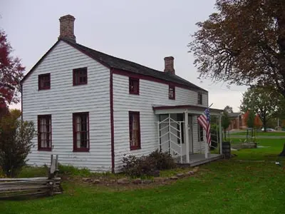
Folk and Popular Housing Styles
Housing architecture reflects cultural traditions, available materials, and historical context.
Folk Housing Styles (Regional and Traditional)
New England: Boxy homes with steep roofs and central chimneys; designed for cold, snowy climates.
Middle Atlantic: Two-story homes with gables, often made of brick or stone; practical and influenced by German and Dutch settlers.
Lower Chesapeake/Tidewater: Raised foundations, large porches, and broad eaves to suit warm, humid climates and flood risks.
Popular Housing Styles (Widespread and Mass-Produced)
Modern Style (Post-WWII): Emphasized functionality, minimal ornamentation, and mass production to meet housing demand.
Neo-Eclectic (since the 1960s): A blend of traditional and modern designs, reflecting diverse preferences and suburban development.

FAQ
Political ideologies can have a profound and lasting impact on the development of cultural landscapes by dictating land use, architectural styles, and urban design based on governance systems and national identity. Authoritarian regimes may build imposing government buildings, statues, and plazas to project power and authority. In contrast, democratic societies often emphasize public spaces, monuments to civil liberties, and community-centered architecture. Political ideologies also shape:
The distribution of land ownership (e.g., collectivized farms under communism).
The appearance and location of monuments, flags, and government symbols.
Street names and public building dedications reflecting historical figures or events aligned with the political ideology.
These elements embed political values and narratives directly into the landscape, reinforcing state identity and citizen loyalty through physical space.
Migration introduces new cultural traits into a landscape, often blending them with existing ones or displacing them entirely. Over time, this can significantly transform the cultural identity of a place.
Immigrants bring language, religion, cuisine, and architectural preferences that influence the built environment.
Ethnic enclaves like Little Italy or Koreatown emerge, characterized by signage in native languages, cultural festivals, and traditional businesses.
Migrant communities adapt their cultural traditions to local environments, creating hybrid forms of expression (e.g., fusion cuisines or blended religious practices).
Rural-to-urban migration drives rapid urbanization, changing agricultural areas into densely populated cities with different spatial organization and economic functions.
These changes are often visible in housing styles, place names, and land use patterns.
Technology transforms how people interact with their environment and shapes the landscape accordingly. It alters transportation, construction, communication, and resource management.
Innovations in construction (e.g., steel, reinforced concrete) enable the creation of skyscrapers and modern infrastructure, dramatically changing skylines.
Advanced transportation systems like subways, highways, and airports influence urban layout and land value.
Satellite imagery and GPS have revolutionized land surveying and planning, creating more efficient and uniform urban developments.
Technological farming equipment and irrigation systems expand agricultural boundaries and change rural landscapes.
Overall, technology accelerates landscape transformation and often leads to homogenization across regions due to globally shared architectural trends and urban planning models.
In rural areas, religious beliefs and practices can dictate how land is used, what structures are built, and how space is organized. These spiritual influences often create visually distinct landscapes that reflect the cultural priorities of a community.
Sacred sites such as shrines, pilgrimage routes, cemeteries, and temples are often prominently located within or near villages.
Agricultural practices may follow religious calendars, influencing crop cycles and land use timing.
Land may be designated for communal religious use, such as monastic farming or burial grounds.
Architectural styles reflect theological principles—simple, humble structures in some traditions versus ornate and symbolic buildings in others.
Rural religious landscapes often remain more preserved and less commercialized, maintaining a strong link to historical traditions and local identity.
Tourism can lead to the conservation or commercialization of cultural landscapes, depending on how it is managed. While it can protect and fund heritage sites, it can also dilute authenticity.
Historic districts may be preserved and restored to attract visitors, leading to strict regulations on modifications and appearances.
Local economies shift toward service-based industries like hospitality and retail, often changing the landscape with new infrastructure.
Over-tourism may result in crowding, environmental degradation, and displacement of local residents or traditional businesses.
Cultural performances, crafts, and food may be adapted to appeal to outsiders, potentially distorting their original meaning.
Practice Questions
Explain how sequent occupancy contributes to the complexity of cultural landscapes, using a specific example.
Sequent occupancy refers to the process by which different cultural groups leave their imprint on a place over time, resulting in a layered cultural landscape. Each group modifies the land to reflect their cultural practices, architecture, and needs. For example, in Mexico City, the remnants of the Aztec capital Tenochtitlan are still present beneath Spanish colonial buildings, which are now overlaid with modern skyscrapers and urban infrastructure. This mixture of Indigenous, colonial, and contemporary elements creates a complex cultural landscape that reflects historical transitions and the coexistence of multiple cultural influences over time.
Identify and describe one type of cultural region, and explain how it shapes the cultural landscape.
A formal cultural region is defined by shared traits such as language, religion, or ethnicity, and typically has clearly defined boundaries. An example is Quebec in Canada, where the dominant language is French and Catholic traditions are prominent. This cultural unity is reflected in the landscape through French-language signage, colonial-style architecture, and the presence of Catholic churches. These features create a cohesive visual and cultural identity that distinguishes the region from English-speaking provinces. Formal regions shape cultural landscapes by promoting uniform cultural practices and values that influence how people design and interact with their physical surroundings.
